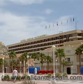
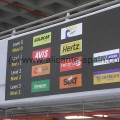
As impressive looking the new terminal building at Alicante Airport might be, as confusing is driving to it by car. Below a detailed step-by-step map of Alicante airport and various photos I took to help you better find your way around.
Remark: I tried to draw the airport map in a way to highlight roads, because that’s what this is all about. The map is certainly not at all perfect, but I hope it fulfills the purpose of helping you driving around Alicante airport by car.
Step by Step Driving Around Alicante Airport By Car
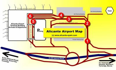 To the left my “self-made” map of Alicante airports roads and streets.
The numbers on the map refer to the pictures shown below, hopefully guiding you well driving around the airport area.
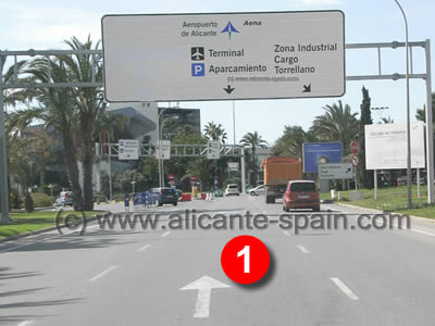 Coming into Alicante airport area, take the middle lane direction Terminal Building.
(Take extra care when you come in via the N332 as you enter the area on the left lane, with other cars “overtaking” you at your right side. )
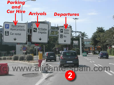 Depending on which part of the airport you want to go you pick one of the three lanes right underneath the signs. (Note: I enlarged the signs on the photo for better visibility).
Please also note, currently the signs are only in spanish and valenciano language. (well, perhaps it takes a while for the airport company to understand what “international” in “Alicante international Airport” stands for 😉 . This way, for what its worth, you at least learn what arrival and departures means in valenciano too.
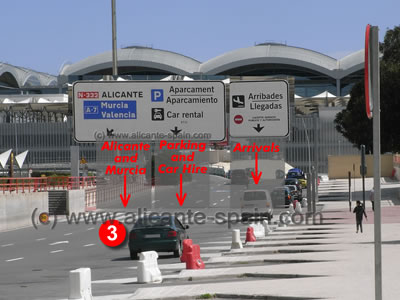 If you take the direction to parking area and arrivals, you will see that the street splits into three separate lanes.
As shown on the signs, you take either the lane back to Alicante and Murcia, or for the parking garage and car hire drop off area or you head to the arrivals area.Note: Signs shown on the photo left are enlarged for better visibility.
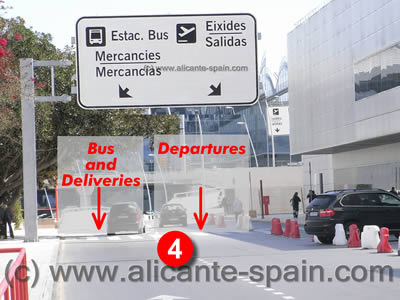 If you took the departures lane at the corner sign (image 2), you will be led to a simple fork where you want to take the right hand lane to the Alicante airport departure area.
Only if you are driving a charter bus or have deliveries for the airport, you should consider the left lane :-).Note: Again, for better visibility I zoomed in the sign in the image shown.
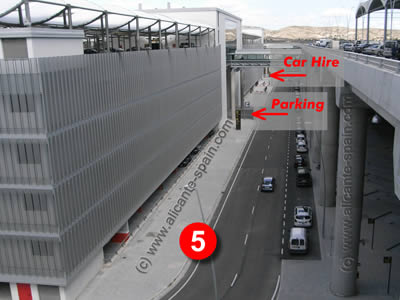 If you took the parking and car hire lane, you will end up at the back of the parking building of the airport. The Alicante airport parking building (or should i call it parking garage ? ), has two entrances.
The first entrance is parking. The second is for your rental car or car hire drop off.>> Tips on parking at Alicante airport here>> Tips on car hire procedures at Alicante airport here
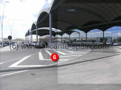 The road to Departure gets you up to the top level 2 of Alicante airports terminal building, the departure level.
>> For detailed help on Departure and Check-In at Alicante airport please click here.
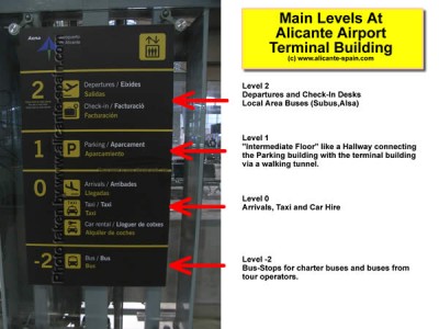 The terminal building has one additional level (Level 1) between the departure area and arrival area. This “in-between” level only hosts a tunnel passage-way connecting the parking building with the terminal building. (It is not shown in the picture No.5 above.).
At the lowest level (Level -2) is the “bus level”, which is where most buses ( all charter buses) stop. (The exception are some local subus and alsa buses, which stop at the end of the departure area).
I hope the above map and images of the roads and streets around Alicante airport help you in finding your way to the right areas. At first I also found it confusing, as with most new things I guess. But once you got a basic grasp of all possible lanes to the terminal building, driving to Alicante airport is not that difficult anymore.
>> Click here to go back to our main Alicante airport information page.

