 With the inauguration of the new terminal building at Alicante Airport in March 2011, the two older terminal buildings got closed.
I drew several outline maps of the area around Alicante airport as well as departure and arrival levels at the terminal building. Not meant to be fully detailed, but hopefully good enough to guide you through your next flight to the Costa Blanca’s largest airport.
Click on each map image for an enlarged view in a separate window.
Alicante Airport Maps |
|
|---|---|
| (click on the images for an enlarged view) | |
 |
Alicante Airport Area MapDetailed explanation on how to get to Alicante Airport can be found here. |
 |
Driving To Alicante AirportOverview on all main streets and lanes to take if you drive to Alicante airport by car. |
 |
Alicante Airport Departure Area Map
Further Tips on departing from Alicante Airport here. |
 |
Alicante Airport Arrival Area MapFor Detailed Tips on arriving at Alicante Airport click here. |
 |
Alicante Airport Car Rental |
 |
Alicante Airport ParkingA map explaining parking at Alicante airport . |
 |
Help Map For People With DisabilitiesWhere you can find help when you look for a wheelchair or any assistance is explained on our help for people with disabilities article here. |
Have A Look At These Related Articles...
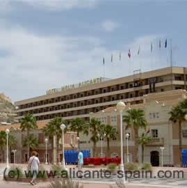 |
Find A Good Hotel In Downtown Alicante or Near Alicante AirportIts never easy to find a good hotel. In my recommended Alicante Hotel list, I do recommend some really good hotels around downtown as well as some close to the airport...click here for the Alicante Hotels article |
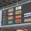 |
What Car Hire Company To Choose?Before you hire your car, you might want to consider some basics for your next car hire in and around Alicante ...to read more click here |
